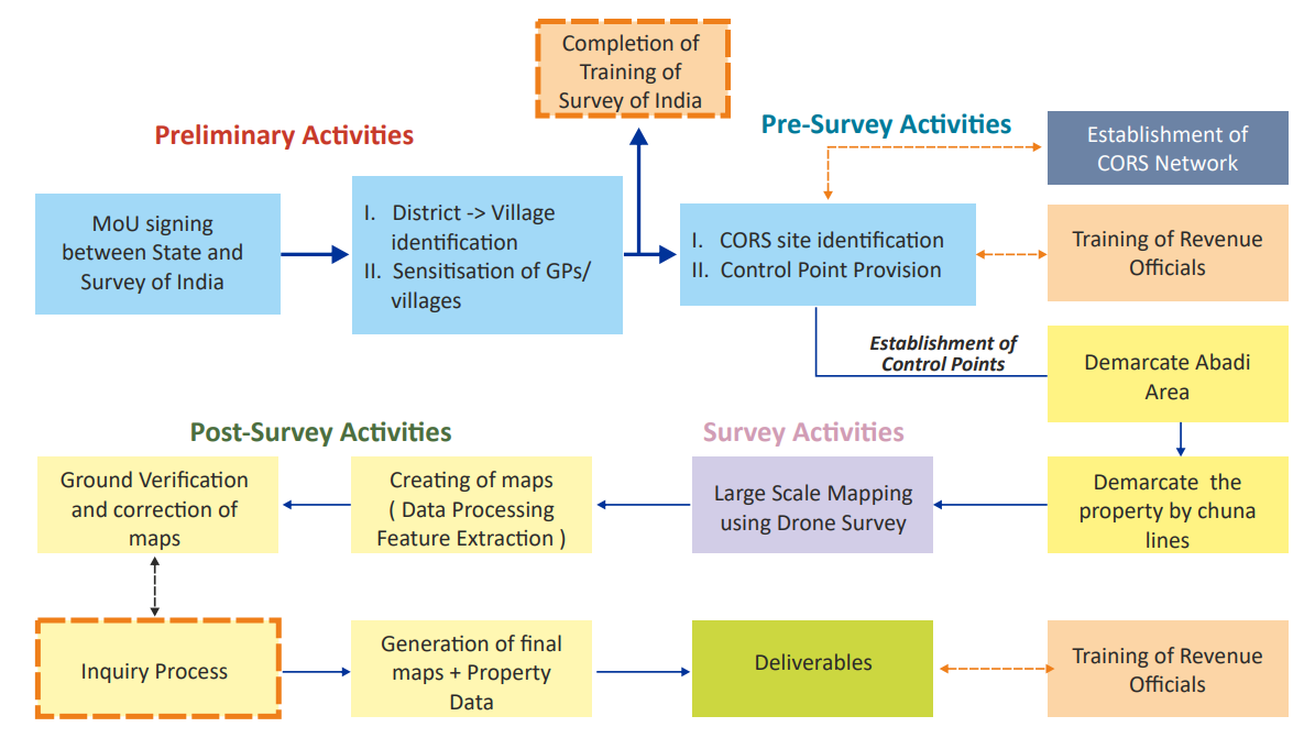
SVAMITVA Scheme
Why in News?
Recently, the Report of the Expert Committee on SVAMITVA Scheme was released during the National Conference on SVAMITVA Scheme and Rural Planning in Madhya Pradesh.
The report provides the guiding principles that States may adopt, in order to realize the objectives of the SVAMITVA Scheme holistically.
What is theScheme?:
SVAMITVA stands for Survey of Villages and Mapping with Improvised Technology in Village Areas.
It is a center sector scheme which was launched nationally on the occasion of National Panchayati Raj Day on 24th April 2021.
About Expert Committee:
The Expert Committee was formed in 2022 consisting of domain experts from Land Governance, Banking, Survey of India, National Informatics Centre (NIC) -Geographic information system (GIS), State Revenue and Panchayati Raj Departments, Industry and premier Planning and Architecture Institutes.
Report’s Recommendations:
To create systems that promote transparency in the implementation of the scheme.
Promote the adoption of record of rights for availing bank loan.
Develop linkages between different departments for informed decision-making related to property tax assessment and collection.
Wider adoption of SVAMITVA data-sets by government and private agencies as per new geospatial guidelines.
Adoption of RADPFI (Rural Area Development Plan Formulation and Implementation) Guidelines and SVAMTIVA data for accurate village level-planning
Increasing capacity at State, District and Block level for GIS skill sets, among others.
Nodal Ministry:
Ministry of Panchayati Raj (MoPR)
Survey of India is a Technology Implementation Agency.
Aim:
To provide an integrated property validation solution for rural India.
To provide the ‘record of rights’ to village household owners in rural areas and issue Property Cards.
The demarcation of rural areas would be done using Drone Surveying Technology.
Features:
The demarcation of rural inhabited areas would be done using CORS (Continuously Operating Reference Stations) Networks which provides mapping accuracy of 5 cm.
This would provide the ‘record of rights’ to village household owners possessing houses in inhabited rural areas in villages.
It will cover around 6.62 Lakh villages of the entire country during 2021-2025.
.jpg)


.jpg)
.jpg)