EARTH QUAKE-भूकंप
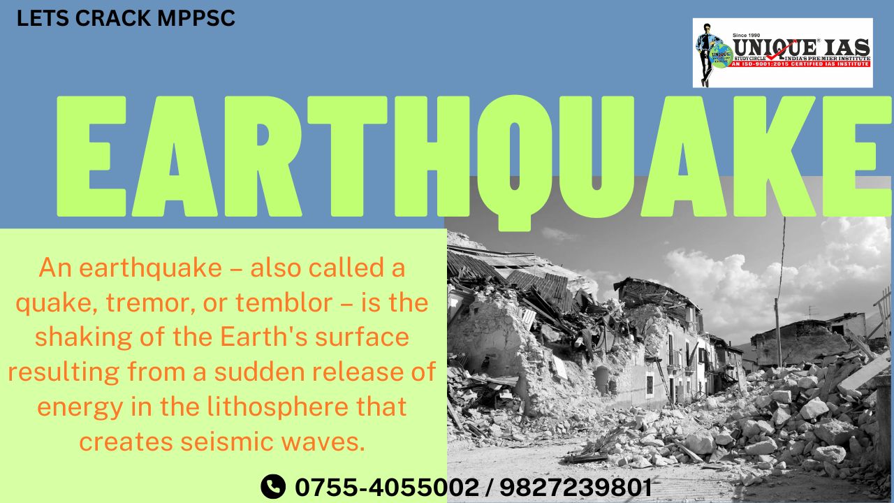
The shaking of the upper crust of the earth because of tectonic reason is known as earthquake. The place at which earthquake starts is known as focus.
Hypocentre-
The point where the energy is released is called the focus of an earthquake, alternatively, it is called the hypocentre.
Epicenter-
The shortest distance from focus meets with one centre of the earth is known as epicenter.
The earthquake causes maximum harm around epicenter.
Types –
-Based on Place-
1. Oceanic earthquake 2. Continental earthquake.
-Based on the depth of focus
The earthquakes are divided into three zones: shallow, intermediate, and deep based on their depth which range between 0 – 700 km.
The strength of shaking from an earthquake diminishes with increasing distance from the earthquake's source, so the strength of shaking at the surface from an earthquake that occurs at 500 km deep is considerably less than if the same earthquake had occurred at 20 km depth.
1-Shallow earthquakes have a focus 0 – 70 km deep.
2-Intermediate earthquakes have a focus 70 – 300 km deep.
3-Deep earthquakes have a focus 300 – 700 km deep.
Worlds largest earthquake & volcano are produced at-
1-Circum pacific belt known as Ring of Fire.-
The Ring of Fire, is a path along the Pacific Ocean characterized by active volcanoes and frequent earthquakes.
-The Ring of Fire is the result of plate tectonics (Convergent, Divergent Plate Boundary, Transform Plate Boundary).
-Majority of Volcano & Earthquakes: Seventy-five percent of Earth’s volcanoes—more than 450 volcanoes—are located along the Ring of Fire.
-Ninety percent of Earth’s earthquakes occur along its path, including the planet’s most violent and dramatic seismic events.
- Some Volcano Circum-Pacific Belt: Mount Fuji of Japan, The Aleutian Islands of US, Krakatau Island Volcano in Indonesia, etc.
Formation of Hot Spots: The Ring of Fire is also home to hot spots, areas deep within the Earth’s mantle from which heat rises.
Circum-Pacific Belt harbors the majority of global Volcanic eruptions & Earthquakes, it holds immense significance regarding the study of the earth’s interior.
|
Q -In which belt, the volcanic eruption is maximum?(PSC-2021) (a)Mid continental (b)Circumference (c) Mid Atlantic (d) Intraplates Volcanoes Answer:-(B) (Q) Fire rings of Pacific Ocean. (please answer in 1or 2 lines)(PSC- Mains -2016) |
2-The Alpide Belt, passes through the Mediterranean region eastward through Asia and joins the Circum-Pacific Belt in the East Indies.
3-Mid-Atlantic Ridge. The ridge marks where two tectonic plates are spreading apart (a divergent plate boundary).
The Earth’s major earthquakes occur mainly in belts coinciding with the margins of tectonic plates.
The Earth’s major earthquakes occur mainly in belts coinciding with the margins of tectonic plates. Earthquakes are caused by the sudden release of energy within some limited region of the rocks of the Earth. The energy can be released by elastic strain, gravity, chemical reactions, or even the motion of massive bodies. Tectonic earthquakes are explained by the so-called elastic rebound theory.
Elastic rebound Theory
Henry Fielding Reid, Professor of Geology at Johns Hopkins University, concluded that the earthquake must have involved an "elastic rebound" of previously stored elastic stress.
If a stretched rubber band is broken or cut, elastic energy stored in the rubber band during the stretching will suddenly be released. Similarly, the crust of the earth can gradually store elastic stress that is released suddenly during an earthquake.
This gradual accumulation and release of stress and strain is now referred to as the "elastic rebound theory" of earthquakes.
Most earthquakes are the result of the sudden elastic rebound of previously stored energy.
The following diagram illustrates the process. Start at the bottom. A straight fence is built across the San Andreas fault. As the Pacific plate moves northwest, it gradually distorts the fence. Just before an earthquake, the fence has an "S" shape.
When the earthquake occurs the distortion is released and the two parts of the fence are again straight; but now there is an offset.
This diagram greatly exaggerates the distortion. Actually, the distortion is spread over many miles and can only be seen with precise instrumentation.
Earthquakes associated with this type of energy release are called tectonic earthquakes.
Seismograph –
An instrument which is used to measure of earthquake.
1-Magnitude-
(quantify the energy released)
Currently magnitude is measured in Richter scale. The …..Richter magnitude scale (also Richter scale) assigns a magnitude number to quantify the energy released by an earthquake. The Richter scale, developed in the 1930s, is a base-10 logarithmic scale, which defines …..magnitude as the logarithm of the ratio of theamplitude of the seismic waves to an arbitrary, minor amplitude.
As measured with a seismometer, an earthquake that registers 5.0 on the Richter scale has a shaking amplitude 10 times that of an earthquake that registered 4.0, and thus corresponds to a release of energy 31.6 times that released by the lesser earthquake.(IAS-Exam)
The Richter scale was succeeded in the 1970s by the moment magnitude scale. This is now the scale used by the United States Geological Survey to estimate magnitudes for all modern large earthquakes.
2- Intensity of shaking-
Is measured on the modified Mercalli scale. The shallower an earthquake, the more damage to structures it causes, all else being equal.
Magnitude measures the …..energy released at the source of the earthquake. Magnitude is determined from measurements on seismographs.
Intensity measures the strength of shaking produced by the earthquake at a certain location. Intensity is determined from effects on people, human structures, and the natural environment.
|
Magnitude |
Average number per year |
Modified Mercalli Intensity |
Description |
|
0 – 1.9 |
>1 million |
— |
micro – not felt |
|
2.0 – 2.9 |
>1 million |
I |
minor – rarely felt |
|
3.0 – 3.9 |
about 100,000 |
II – III |
minor – noticed by a few people |
|
4.0 – 4.9 |
about 10,000 |
IV – V |
light – felt by many people, minor damage possible |
|
5.0 – 5.9 |
about 1,000 |
VI – VII |
moderate – felt by most people, possible broken plaster and chimneys |
|
6.0 – 6.9 |
about 130 |
VII – IX |
strong – damage variable depending on building construction and substrate |
|
7.0 – 7.9 |
about 15 |
IX – X |
major – extensive damage, some buildings destroyed |
|
8.0 – 8.9 |
about 1 |
X – XII |
great – extensive damage over broad areas, many buildings destroyed |
|
9.0 and above |
< 1 |
XI – XII |
great – extensive damage over broad areas, most buildings destroyed |
Magnitude / Intensity Comparison
The following table gives intensities that are typically observed at locations near the epicenter of earthquakes of different magnitudes.
|
Magnitude |
Typical Maximum |
|
1.0 – 3.0 |
I |
|
3.0 – 3.9 |
II – III |
|
4.0 – 4.9 |
IV – V |
|
5.0 – 5.9 |
VI – VII |
|
6.0 – 6.9 |
VII – IX |
|
7.0 and higher |
VIII or higher |
After 4th unit, earthquake becomes harmful.
Iso -Seismic lines –
The circular lines which joins the equal intensity of the earthquake.
1-Primary Waves –
known as P- Waves. Began at focus and they reach the earth. These are longitudinal waves. (like sound waves) .
2-Secondary waves –
known as S-waves : They reach after primary waves. These are transverse waves.
(like light waves).
3-Surface Waves (L waves)-most destructive
Also called as long period waves. They are low frequency, long wavelength, and transverse vibration. Generally affect the surface of the Earth only and die out at smaller depth. Develop in the immediate neighborhood of the epicenter.
They cause displacement of rocks, and hence, the collapse of structures occurs. These waves are the most destructive.
|
Q. Discuss the geophysical characteristics of Circum-Pacific Zone. (150 words, 10 marks)(IAS Exam-2020) Q Describing various causes of origin of earthquake, give detailed account of 2001 earthquake of Kutch. (please answer in 300 words)(PSC- Mains -2018) |
.jpg)


.jpg)
.jpg)